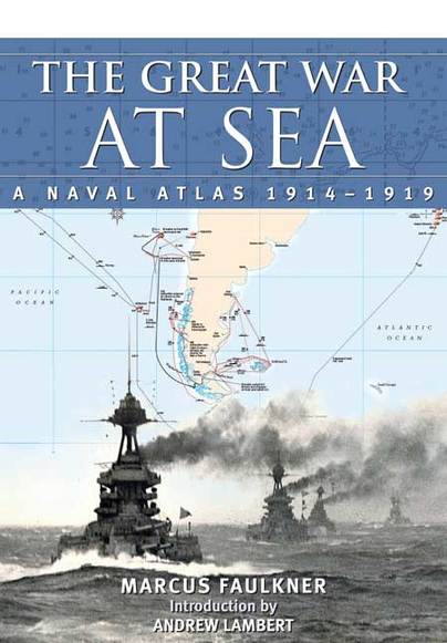
The Great War at Sea: A Naval Atlas 1914-1919 (ePub)

File Size: 11.6 MB (.epub)
Pages: 170
ISBN: 9781848323629
Published: 23rd September 2015
In the vast literature of the First World War there has never been a naval atlas that depicts graphically the complexities of the war at sea, and puts in context the huge significance of the naval contribution to the defeat of Germany.
With more than 125 beautifully designed maps and charts, the atlas sets out to visualise the great sea battles as well as the smaller operations, convoys, skirmishes and sinkings. As well as the well known set pieces such as the battles of Coronel, Heligoland, Dogger Bank and Jutland, the Dardenelles campaign, the North Sea and Channel operations, and the responses to merchant ship losses, the atlas looks at the many significant events at sea which impacted on the land war and which have had scant coverage in much of the naval literature of the era. The distant waters defence of trade routes, the impact of the United States navy in Europe, operations in the Baltic and northern Russia, and Japanese naval contributions in the Middle East are just some of the themes given a new and exciting presentation
No other work has attempted such an ambitious coverage of the naval war in this period and it will become the definitive reference work for enthusiasts and historians as well as general readers fascinated by the naval war that extended across all the world's oceans and had such a significant impact on the outcome of the war.
As might be expected, Andrew Lambert's introductory essay is a masterly outline of the role of Naval forces in the First World War.
Mariner's Mirror
'The Great War at Sea' keeps the perspective global; we are all guilty of thinking of the war, even of the British war, as 'The Western Front'. It is also a magical book, something that revives one's belief in the qualities and values of print over content online. It is also a 'must have' reference.
Western Front Association, J. Venon
IT is said that a picture is worth a thousand words and perhaps a well-designed and drawn map or chart may well take the place of as many words. This is the case of ‘The Great War At Sea’ as the work depicts the maritime war 1914-1919 in superb graphical detail which should satisfy the range of readers from the merely interested to the deep specialist.
Australian Naval Institute – Tim Coyle
The author displays his decades of cartographic experience as he marries the superbly presented charts with succinct synopses of the World War 1 maritime engagements. Strategic and operational overviews set the scenes for specific battles and campaigns which are played out in the tactical manoeuvring of the participating ships, submarines and fledgling aircraft. Typical of the high presentation quality, and of particular interest to Australian readers, are the background and charts of the Dardanelles campaign. From the Dardanelles Campaign Overview we progress to the Dardanelles Bombardment, February 1915; the attack of the Narrows, 18 March 1915 to the Landing Operations and to the final Naval Losses at the Dardanelles.
As expected there is extensive Battle of Jutland coverage – probably the best ever published – covering the Deployment, the Run to the North, the Main Engagement, the Night Engagement and the Withdrawal. In all there are 110 folios covering the strategic, operational and tactical aspects of the war at sea; surely a definitive compendium. The respected naval historian Andrew Lambert precisely and succinctly overviews the war at sea in his introduction. The book draws heavily on Admiralty primary sources supported by British and German official histories and respected published works.
Read the full review here
Invaluable for anyone who wishes to follow the naval campaigns of The Great War of a century ago.
Ships in Scale, July/Aug 2016 – Roger Marsh
As with its predecessor, the volume is presented n the form of a large atlas and is beautifully produced. The fine, detailed maps by Peter Wilkinson form the core of the book and offer an excellent visual guide to the real course of the battles and naval campaigns of the war. His superb maps are accompanied by very informative texts on the particular action depicted in them.
Like it, a massive and dedicated undertaking has evidently been achieved to bring this superb work to fruition. The Great War at Sea, A Naval Atlas 1914-1919 is certain to become, for many years ahead, a valued and standard work of reference on World War 1 as fought at sea.
The Great War at Sea: A Naval Atlas 1914-1919 has more than 125 specially drawn and annotated maps, deserving a place in the library of anyone serious about studying the maritime side of WW1. It is an essential companion to many other books about the period. Every major engagement is here and many minor ones too, some of them quite obscure. There is a superb foreword by Andrew Lambert who in a few thousands words perfectly summaries the course of navies. In particular he writes about the Royal Navy winning the war at sea to enable the delivery of
Warships IFR, July 2016 - Peter Hore
over-whelming military resources that decided the land war on the Western Front. Britain was, however, bankrupted by the effort.
A picture is worth a thousand words and in this case a naval chart is worth at least a thousand words as demonstrated by this sumptuously produced large size, naval atlas, which tells the complete story of the Great War at sea. It is a prequel to Faulkner's excellent Naval Atlas of the Second World War. The 125 expertly drawn maps and charts are again created by Peter Wilkinson and between them cover the conflict worldwide in pretty good detail. Once again the scene is set by a clear, well written brief outline history of the conflict at sea, with a good strategic overview by Andrew Lambert in his succinct introduction.
Scuttlebutt, ed. No 52, 2016 - John Roberts
The atlas is organised in roughly chronological order and is divided into years. Each year starts with a double page map of the world with a summary of the naval operations in that year. The book can be read as a complete history in itself or, because each map is designed to be as
self-contained as possible, can be used as a reference for those concerned with a particular campaign or operation.
This outstanding naval atlas provides easy comprehensible coverage of some of the more complex operations with clear track charts. The six full size charts of the battle of Jutland provide a classic example of the advantage of maps over lengthy confusing text. The majority of the specially created maps are based on updated versions of the original, official Admiralty maps. Subsequent research has enabled the maps to be corrected and modern design techniques have made the maps much clearer to understand, particularly for the more complex operations. This unique atlas enables Marcus Faulkner to maintain his special niche in the masses of naval history books covering the World Wars at sea. This excellent book will become and essential reference book in all naval libraries and is most highly recommended.
It is an indispensable reference for newcomers to the Great War at sea as well as old hands alike, and should deservedly earn a place on the shelves of naval historians and wargamers. Highly recommended!
Battlesfleet, Journal of the Naval Wargamers Society
Subtitled ‘A Naval Atlas 1914 - 1919’ this book is just that. It is absolutely beautifully produced and carries an introduction by Andrew Lambert that summarises the naval part of the conflict. This alone is a masterly analysis and exposition of sea power, emphasising the attritional nature of naval war and how set-piece battles may happen, but are not the aim. He explains how Germany had lost the war before they even started it and how this led inexorably into the massive war crime of the U-Boat campaign.
Army Rumour Service
There are 164 pages of maps of theatres of war and track charts of particular actions, chronologically arranged from the very start of the war to the scuttling of the defeated German fleet at Scapa, each year opening with a tour d’horizon of the year’s events and campaigns. Each map or diagram is accompanied by a description of the activity depicted. Peter Wilkinson’s standard of draughtsmanship and presentation is extraordinarily high. Every theatre of war is covered and the detail is exhaustive.
The British naval historian Marcus Faulkner offers us a magnificent atlas of naval battles of the First World War to the intervention of Western powers in the Civil War Russia...
Le Fauteuil de Colbert
... In all cases, it is a beautiful object that wishes to observe the Great War on the seas and oceans, from the Atlantic to the Pacific.


