Google Books previews are unavailable because you have chosen to turn off third party cookies for enhanced content. Visit our cookies page to review your cookie settings.
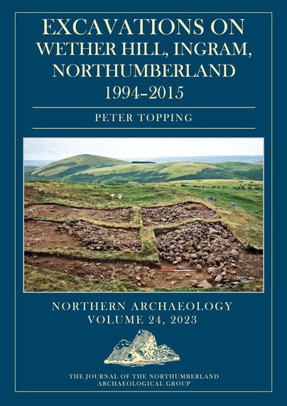
Excavations on Wether Hill, Ingram, Northumberland, 1994–2015 (Hardback)
Imprint: Oxbow Books
Series: Northern Archaeology
Pages: 152
Illustrations: Color images
ISBN: 9781789259698
Published: 15th July 2023
Script Academic & Professional
Series: Northern Archaeology
Pages: 152
Illustrations: Color images
ISBN: 9781789259698
Published: 15th July 2023
Script Academic & Professional
You'll be £45.00 closer to your next £10.00 credit when you purchase Excavations on Wether Hill, Ingram, Northumberland, 1994–2015. What's this?
+£4.99 UK Delivery or free UK delivery if order is over £40
(click here for international delivery rates)
Order within the next 10 hours, 29 minutes to get your order processed the next working day!
Need a currency converter? Check XE.com for live rates
(click here for international delivery rates)
Order within the next 10 hours, 29 minutes to get your order processed the next working day!
Need a currency converter? Check XE.com for live rates
The Northumberland Archaeological Group’s (NAG) Wether Hill project spanned the years 1994–2015 and was located on the eponymous hilltop overlooking the mouth of the Breamish Valley in the Northumberland Cheviots. The project had been inspired by the RCHME’s ‘Southeast Cheviots Project’ that had discovered and recorded extensive prehistoric and later landscapes.
The NAG project investigated several sites. Over the 11 seasons of excavation, NAG recorded evidence of residual Mesolithic activity (microliths), a burial cairn containing two Beakers in an oak coffin, which was superseded by a stone-built cist containing three Food Vessels, Iron Age cord rig cultivation and clearance cairns, a series of Middle/Late Iron Age timber-built palisaded enclosures, a cross-ridge dyke, which protected the southern approach to the Wether Hill fort, and sampled the multi-period bivallate hillfort.
The hillfort sequence on Wether Hill began with a succession of palisaded enclosures, which were later replaced by bivallate earth and stone defenses; both phases appear to have been associated with timber-built houses. Eventually the fort was abandoned, and three stone-built roundhouses were constructed in the fort. The 18 radiocarbon dates obtained from various contexts in the hillfort makes this site one of the better dated forts in the Borders.
The chronology of the Wether Hill fort spanned the Middle/Late Iron Age, which corresponds with dates from palisaded enclosures excavated elsewhere on the hilltop spur. Taken together, this evidence provides a snapshot of settlement hierarchies and agricultural practices during the later Iron Age in this part of the Northumberland Cheviots. The excavations also help contextualise some of the RCHME survey evidence, providing data to model chronology, potential prehistoric settlement density and land-use patterns at different time periods in the well-preserved archaeological landscapes of the Cheviots.
"This is a considerately written and beautifully illustrated book (I particularly like the use of drone imagery to give a sense of the scale of the features in the text), which is essential reading for all those interested in Cheviot hillforts and their landscapes."
Current Archaeology
Customers who bought this title also bought...
Other titles in the series...
Other titles in Oxbow Books...


